\n\tNASA’s latest Mars rover, Curiosity, is set to touch down on Mars in an awesome landing at approximately 1:31 AM Eastern Daylight Time on Monday, August 6, 2012. Read my Geekend post for more details about the rover and where to watch the live broadcast.
\n
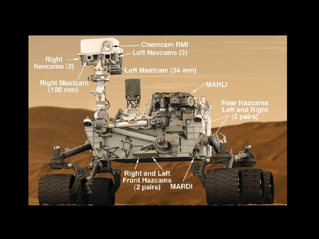
\n\tThis NASA image of Curiosity highlights some of the main features of the rover, including the cameras and devices on the mast and the arm (labeled MAHLI). As you can see, Curiosity has several redundant systems, including duplicate hazard cameras (“HazCams”) on the front and rear, dual NavCams, and dual MastCams. Curiosity is also six-wheel-drive, so it should be able to avoid getting stuck like its predecessor, Spirit.
\n
\n\t
\n
\n\tImage courtesy NASA
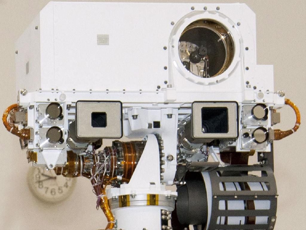
\n\tThis is a close-up of Curiosity’s mast.
\n
\n\tImage courtesy NASA
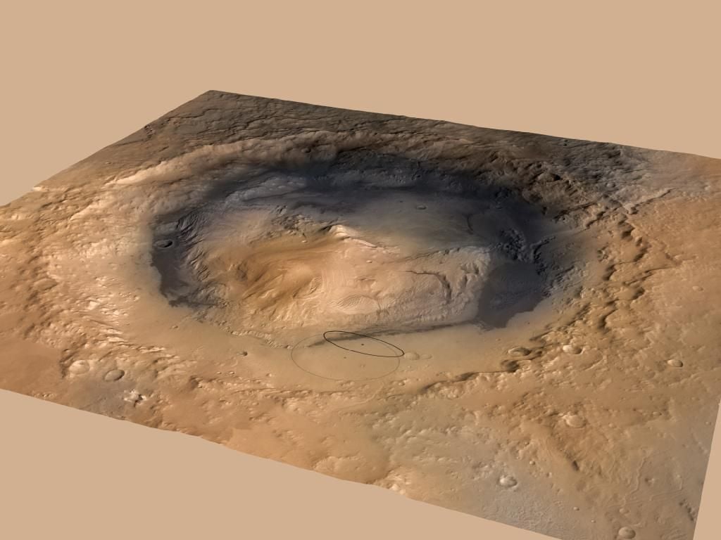
\n\tCuriosity is set to touch down in Gale Crater. The black ellipse on the map is its target zone. Gale Crater is 96 miles wide and contains a 3-mile high mountain at its center.
\n
\n\tImage courtesy NASA
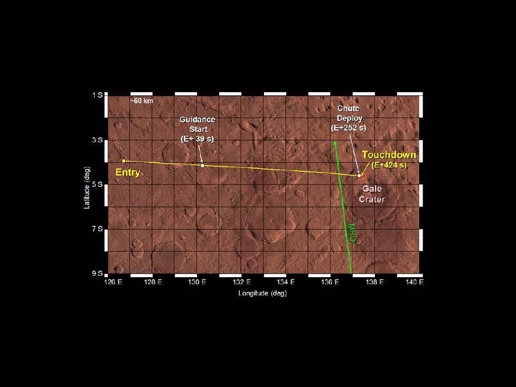
\n\tThis map outlines Curiosity’s travel through the Martian atmosphere until it touches down.
\n
\n\tImage courtesy NASA
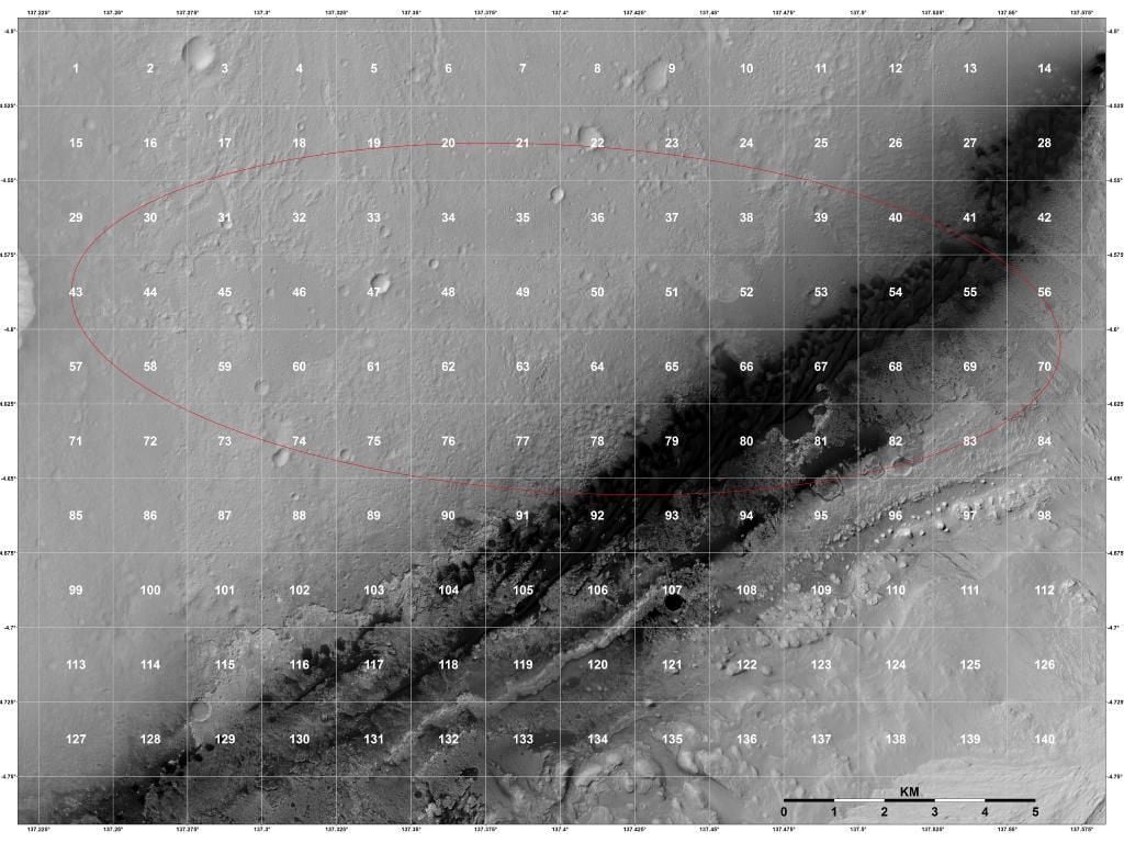
\n\tNASA scientists spent a long time studying the area in and around the target ellipse for potential hazards, as well as points of interest. To ease the study, the region was broken up into 140 quadrangles. The target ellipse is again displayed on this map.
\n
\n\tImage courtesy NASA
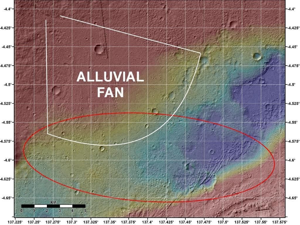
\n\tThis map shows a topographical analysis of the landing region, generated from the HiRISE camera on the Mars Reconnaissance Orbiter. The Alluvial Fan drawn into the map is an area where debris spreads out down a slope. On Earth, this is usually caused by water. It is hoped that this is the case on Mars as well.
\n
\n\tImage courtesy NASA
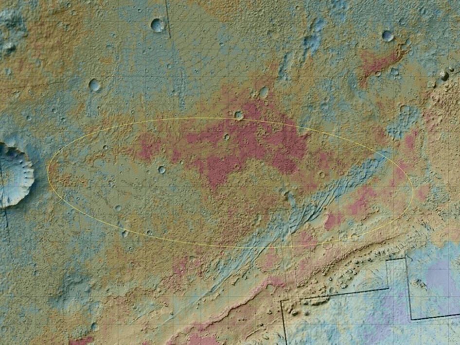
\n\tThis map highlights some of the geology of the landing region by color-coding areas based on the amount of heat they hold on to. You can also see the Alluvial Fan really well in this image.
\n
\n\tImage courtesy NASA
.jpg?w=1024)
\n\tThis graphic shows the landing plan for the Curiosity rover, highlighting the various stages of the landing process. This is coupled well with the “Seven Minutes of Terror” video.
\n
\n\tImage courtesy NASA
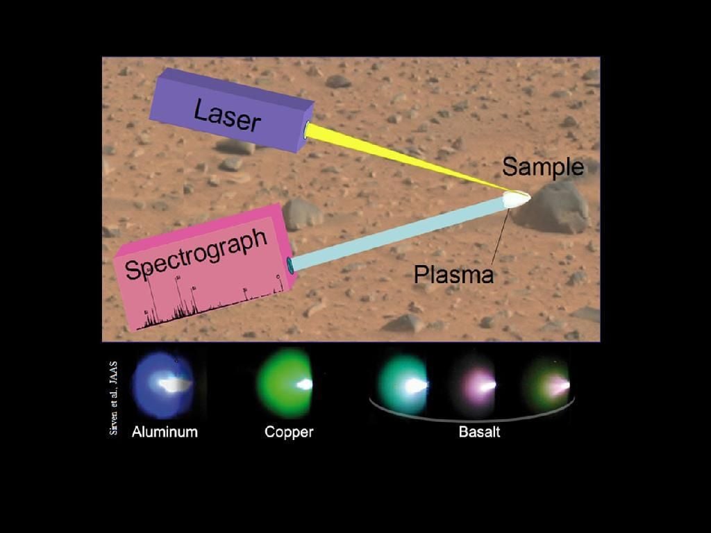
\n\tOne of Curiosity’s tasks is to blast away dust and particulates with a laser so that an onboard spectrograph can analyze the plume for certain minerals. This graphic shows this process and what can be detected by the analysis.
\n
\n\tImage courtesy NASA


