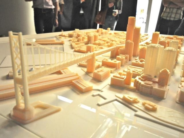
This model of San Francisco took two months to make and cost around $20,000. It was primarily built to help a real estate developer showcase buildings and to help with city planning. It was presented by Autodesk earlier this year.
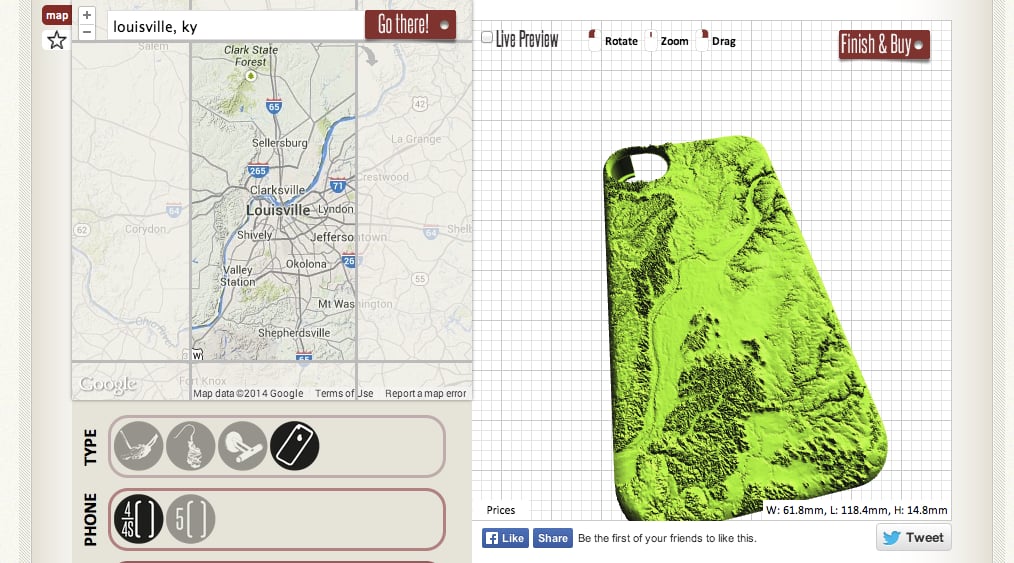
This terrain map of Louisville, Kentucky was designed using the Society for Printable Geography. Simply go to the site, type in your location, and it will generate a printable geographic map using the size of the iPhone as parameters. It takes about a minute to generate, and then you can order the prints through Shapeways or Sculpteo.
HaptoRender is a company that wants to use 3D printing to create tactile maps for the blind and visually impaired. The company will use Openstreetmap data to make the maps of cities and use braille for descriptions, allowing people to have a better understanding of the lay of the land.
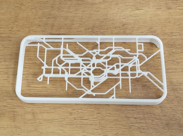
This iPhone case is a map of the London subway. On Shapeways, almost any public rail system is available — from Barcelona to Tokyo. This is available for less than $30 on Shapeways.
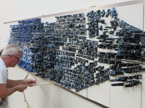
This giant 3D printed model of Manhattan was made to hang in a corporate space for Vick Art Advisors, and was designed by Sparks 3D Design and Quickparts. It was printed in 28 sections, and is 24 feet long.

This topographic map of Mount Rainier is available for purchase on Shapeways. It shows the mountain peak along with the glaciers and valleys surrounding it. There are many maps of mountains available for download or purchase on the site.
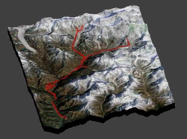
Use Instructables, the open source instructions site for 3D printing, to print your trek, whether it’s on a bike, on feet, or in a car. All you have to do is download the elevation data to print after tracking your trip with a GPS device. This one was made by a user who went to Nepal and mapped his journey.
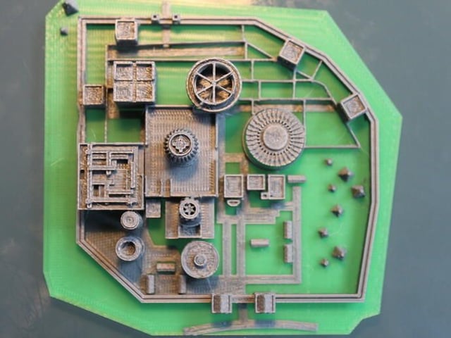
This model of Winterfell was built from scratch, using screen grabs from Game of Thrones. The file is available for download on Thingiverse for free. This version was made with a MakerBot Replicator 2.

Lyndsey Gilpin is a former Staff Writer for TechRepublic, covering sustainability and entrepreneurship. She's co-author of the book Follow the Geeks.


