Pull up your organization’s website on your smartphone. Find your organization’s street address. When you tap the address, does a map app open? People shouldn’t have to cut-and-paste the text of a street address into a map to discover your location. That’s a step many people won’t take, and it may be costing you business.
Tap to map
Wherever you display a street address on your website, link the address to a map location. Follow these steps:
- Go to maps.google.com on the web.
- Type your organization’s address into the search box, and then hit [Enter]. Google Maps will display a pin on a map indicating the location.
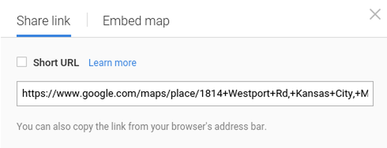
- Select the sprocket in the lower right corner, then choose Share or embed map (Figure A). Copy the link displayed.
Figure A
- Login to edit your website. Select the text where the address displays, then add a link to the map location. Save and update the web page.
Now, when you visit your site, tap the address to open a map. You’ve just made it easier for people to get to your organization’s location. It’s a simple step, but you might be surprised how many organizations–even today–lack location links.
Map multiple locations
If you have more than two locations, make a map instead of a list. For example, one site I saw listed WiFi access points in alphabetical order by the name of the provider. The list forces me to look up addresses, while a map would let me look for locations nearby.
Some sites show multiple locations as an image (e.g., a JPEG that displays a star on each city in which an organization operates). That’s a mistake. With a map displayed as an image, people can’t tap, zoom, or switch to street view.
So, instead of a list or a static image, create a multi-location Google map. Here’s how:
- Go to google.com/mymaps.
- Choose Create a new map.
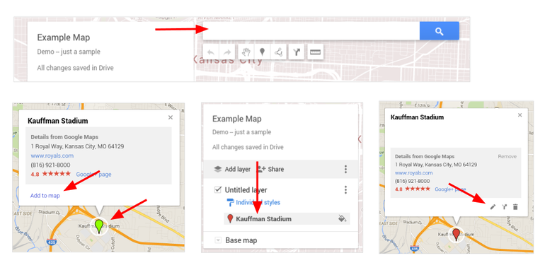
- Add locations to your map (Figure B), with either a series of searches or a list import.
a. Search. Type a keyword in the search box to locate an address or place on the map. Select the pin to display details, then choose Add to map. Next, select the item from the list on the left to edit details–or delete the item.
b. Import. You may also import a list of locations from a CSV, XLSX, or KML (map) file. One column must contain location information in the form of addresses, place names, or latitude-longitude coordinates. You may import a maximum of 2,000 rows to a single map layer.
c. If desired, add a line, shape, or route. Annotate the map to show walking, biking, or driving routes. Or, use a shape to mark an area, such as a sales or service territory.
d. You may also change the base map to any of nine distinct display styles.
Figure B
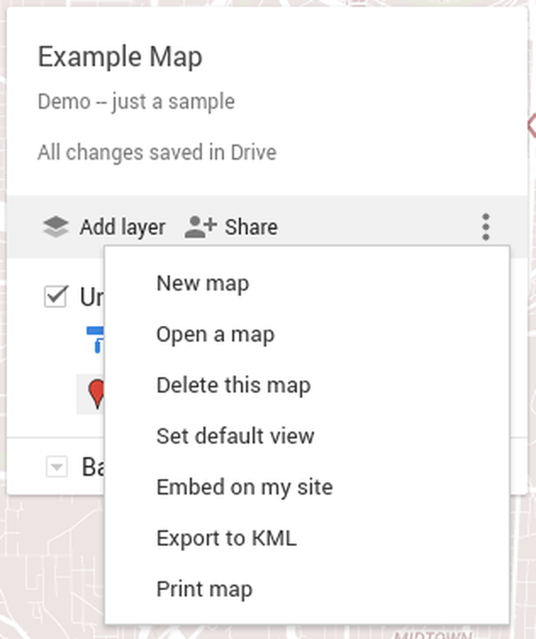
- Select Share, add a map title and description, then save the map (Figure C). After that, you’ll be able to access the standard Google share options. Make the map public if you intend to share it on your website. Select the three vertical dot menu to the right of Share, then choose Embed on my site to obtain the HTML code. Add this code to your website to embed your custom-mapped locations on your website.
Figure C
Custom maps can encourage tourism, retail, and city exploration:
- Google and The New York Times worked together to create g.co/36hours, a sponsored site that displays destinations features in the Times’ 36 Hours weekly travel feature. The feature suggests places to visit when you have 36 hours–essentially a weekend–to explore a city.
- Another map displays the locations of BBQ joints from a list compiled by the Kansas City Star.
- The LA Coffee Map, from LA Weekly, displays some of the best speciality coffeehouses in the city.
In other cases, a custom map might show regions:
- The Rio Rancho Public School District in New Mexico displays the region served by each of the middle schools on a custom map.
Do you make use of Google Maps to identify and locate your business? What problems, if any, have you discovered? Share your experience in the discussion thread below.