\n\tNOTE: If you’d prefer to view this information as a blog post, check out this entry in our Five Apps blog.
\n
\n\tI spend a great deal of time traveling, and I find myself constantly using mapping software. In the process, I’ve discovered that an incredibly diverse variety of mapping software is available. Here are five good options for computer-based mapping.
\n
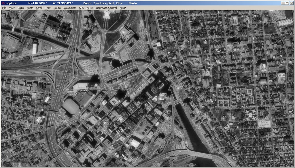
\n\tPhoto: USAPhotoMaps
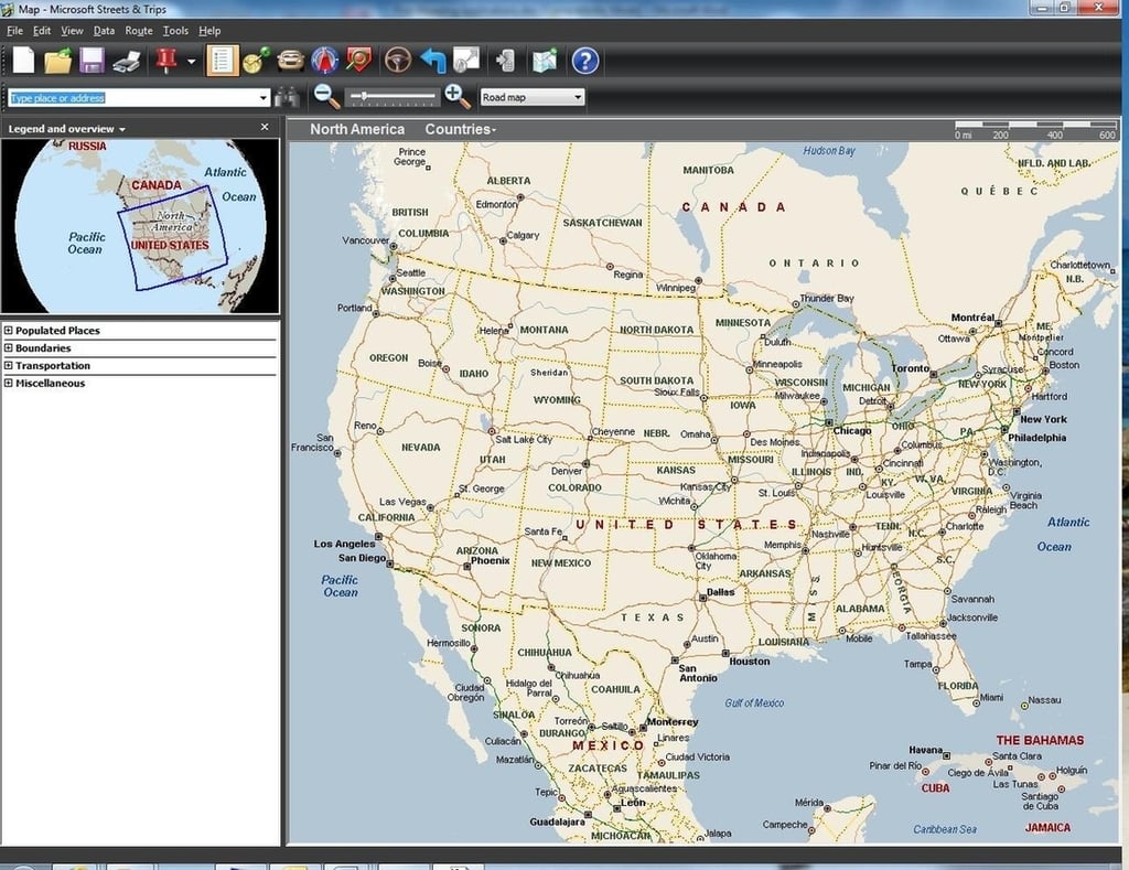
\n\tMicrosoft Streets & Trips has been around for more than a decade and has always been my mapping software of choice. The software sells for $39.95, but there is also a $69.95 version that includes a USB-based GPS receiver. Unlike many other mapping applications, it works even when you don’t have Internet connectivity. That makes the software perfect for use on the laptop I use when I travel.
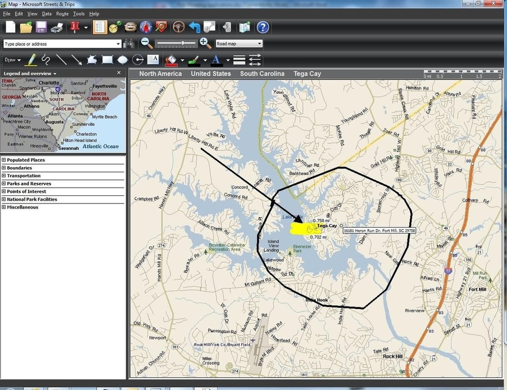
\n\tAnother thing I like is that mapping data can be exported to a mobile device. And I really like the fact that Streets & Trips lets you mark up maps with notes and doodles.
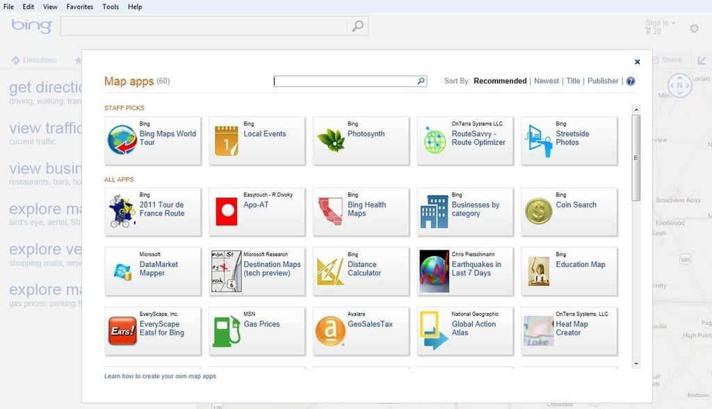
\n\tFirst, Bing Maps is designed to be extensible, and there are numerous apps that build on its capabilities. Many of these apps are free and work seamlessly through a Web browser. Developers have also created countless mapping apps for Windows Phone 7 devices.
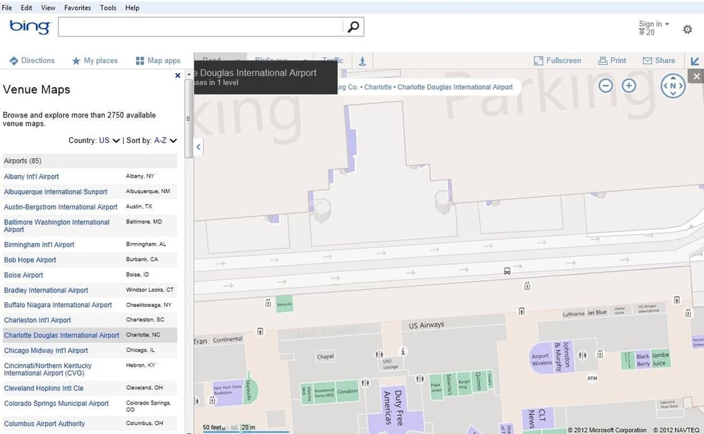
\n\tSecond, Bing Maps offers a venue map feature, which provides indoor mapping of places such as airports, casinos, shopping malls, and stadiums.
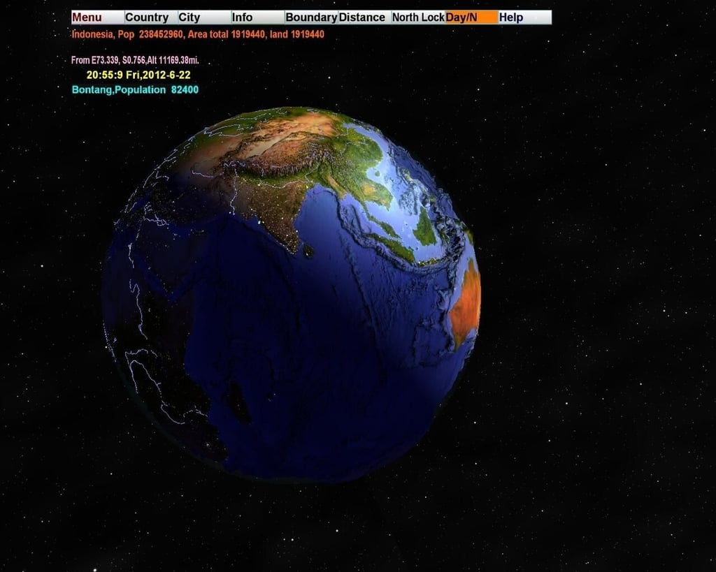
\n\t3D World Map isn’t suitable for getting directions. Instead, it’s designed to serve as a reference tool for those who are interested in geography. As you move around its 3D globe, the software displays stats (such as population) about the various locations.
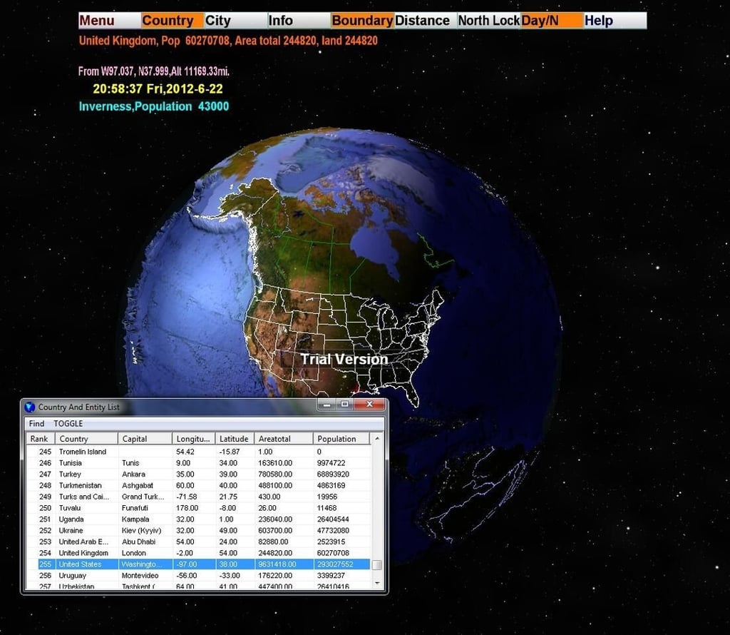
\n\tThe database used by the software seems to be quite extensive. The only thing that appears to be missing is a zoom feature for the globe (although such a feature might exist in the retail version).
\n
\n\tThe software, which retails for $29.95, can also be used as a screensaver and includes a built-in MP3 player.
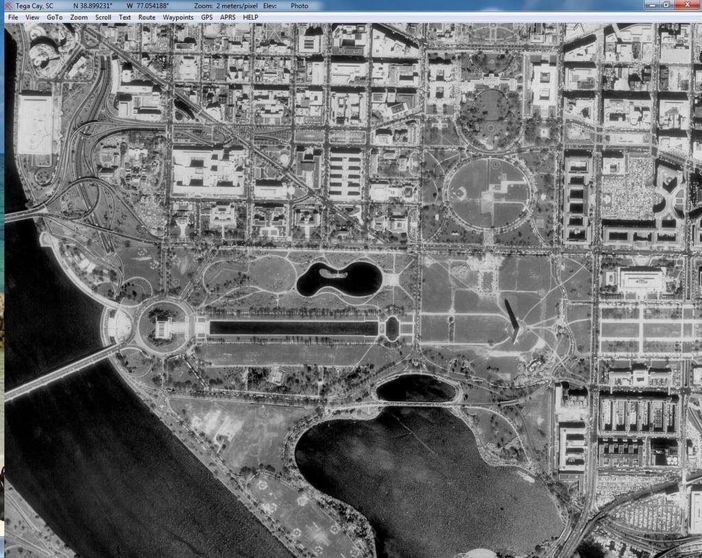
\n\tUSAPhotoMaps from JDMCox is a free mapping utility that lets you build custom maps from Microsoft’s TerraServer database. The software finds locations based on name, address, or GPS coordinates. Once a location is found, high resolution imagery is displayed for it.
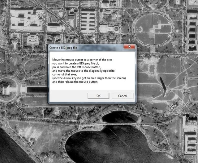
\n\tYou can pan and zoom the image until the desired location is displayed and then create a high resolution JPEG of the selected area. The software can also display elevation data for the selected area.

* 1988 - Started teaching myself about computers \ * 1992 - Mainframe programmer for an insurance company \ * 1993 - Network Administrator for a different insurance company \ * 1996 - Author for The Cobb Group \ * 1998 - Network Administrator for Fort Knox \ * 1999 - CIO for chain of hospitals \ * 2000 - Gave up the corporate rat race to work out of my home. I have been a full time technical author ever since. Visit my Web sites at http://www.brienposey.com and http://www.relevanttechnologies.com \


