Where is Osama bin Laden? Two UCLA geography professors, John A. Agnew and Thomas W. Gillespie, published their theory Thursday on the MIT International Review site (PDF). The UCLA team used satellite imagery (LandsatETM+, Shuttle Radar Topography Mission, Defense Meteorilogical Satellite, QuickBird) to identify three buildings that could possibly house the FBI’s most wanted terrorist who has evaded capture for more than seven years.\n\n
According to their abstract, the team used “biogeographic theories associated with the distribution of life and extinction and remote sensing data over three spatial scales to identify where bin Laden is most probably currently located.”\n\n
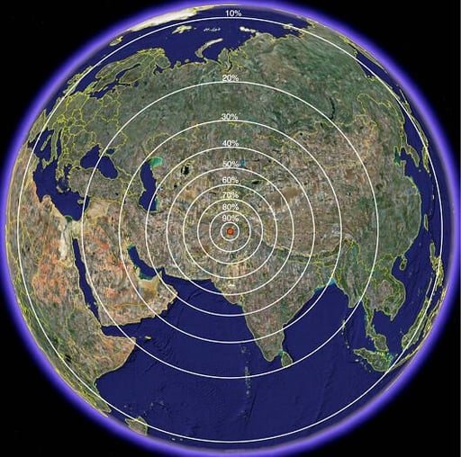
The team says that distance-decay theory would indicate that bin Laden would be closest to the point where he was last located or in a region with similar physical environment and cultural composition. Since he was last sighted in Jalalabad, Afghanistan on November 13, 2001 and heard communicating from Tora Bora, Afghanistan on November 28, 2001, this map shows the probability of his next location (click on the map to enlarge).\n\n\n
NOTE: The UCLA team did not use images from Google Earth to conduct their research. But we were able to locate the sites by using Google Earth from the coordinates given and provide almost exact replicas of the images presented in their research.\n
Credit: UCLA
Island biogeographic theory predicts that bin Laden would be in a larger town rather that a smaller town (easier to blend in). The team identified 26 city islands that were within 20 kilometers of his last known location. After studying the locations, they determined that Parachinar was the largest, fourth-least isolated, and most likely location of bin Laden’s hideout.
Credit: Google Earth
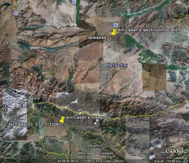
Parachinar is the closest city to bin Laden’s last known location at Jalalabad. \n\n
Credit: Google Earth
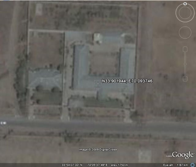
After identifying Parchinar as the most like city, the research team did a house-to-house search of satellite images. They looked for buildings that could satisfy his special circumstances:\n\nAt 6 foot 4 inches bin Laden needed a tall building. He uses a dialysis machine that requires electricity so his location needs an electric grid hook-up or generator. He enjoys physical protection and personal privacy which could mean high walls and space between structures. He needs body guards so there has to be at least three rooms. He also would want to remain protected from aerial views which means nearby trees.\n\n\n\n
This first structure is located at N33.901955, 70.093746.\n\n\n
NOTE: The UCLA team did not use images from Google Earth to conduct their research. But we were able to locate the sites by using Google Earth from the coordinates given and provide almost exact replicas of the images presented in their research.\n\n
Credit: Google Earth
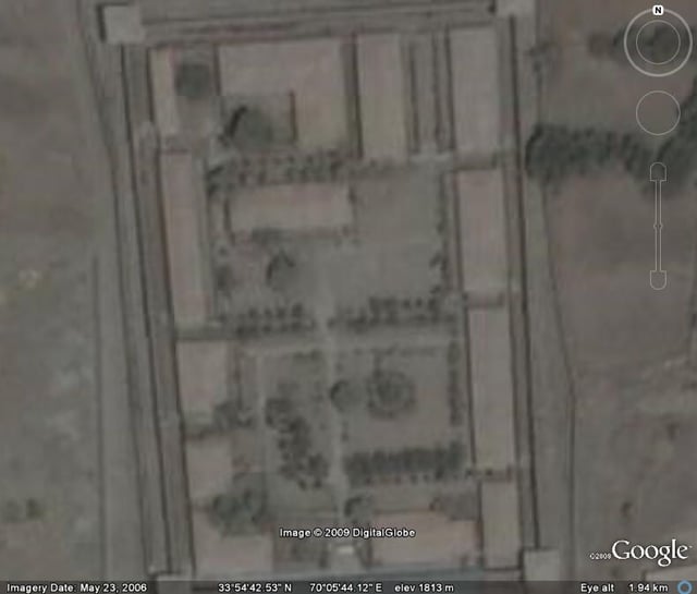
The second structure, located at 33.922694, E70.0959, is thought by the UCLA team to be a prison. But the team points out that it has one of the best maintained gardens in the city.\n\n
Credit: Google Earth
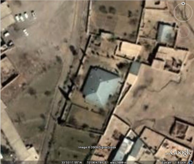
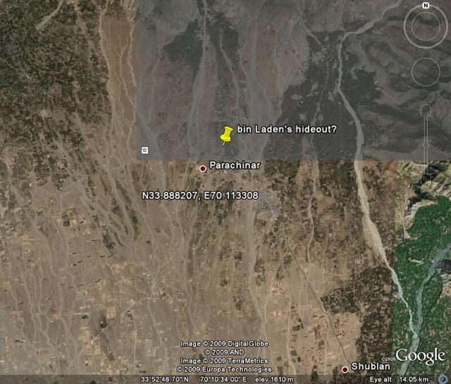
The third structure that met all of the team’s bin Laden criteria is a private residence located at N33.888207, E70.113308. In addition to the three structures that met all six of bin Laden’s life history characteristics, there were 16 additional structures that met five of the six needs.\n\n
Credit: Google Earth


