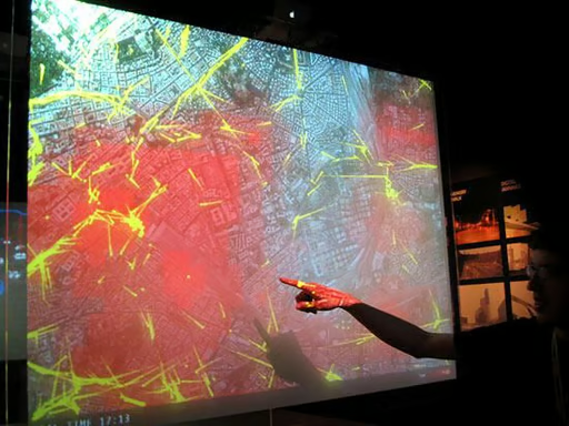
The Massachusetts Institute of Technology has teamed up with Telecom Italia on a real-time mapping system that tracks how people move in urban spaces. The project, known as Real Time Rome, made its debut Friday at the 10th International Architecture Exhibition at the Venice Biennale. The technology maps real-time data gathered from mobile operators and transportation authorities. This projection screen shows buses in yellow, while the red represents the density of people.
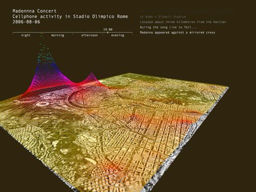
This image captures cell phone activity during Madonna’s appearance at Olympic Stadium in Rome last month. Usage spiked around the stadium and the Vatican.
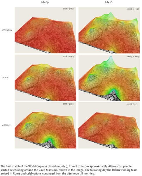
These snapshots illustrate population movement in Rome around the time of the World Cup final and the following day. During the July 9 match, people were less active, most likely gathered around television sets (top and middle, far left). Once Italy won, people began celebrating and congregating at the Circus Maximus (bottom, far left). On July 10, when the Italian team arrived in Rome, people began celebrating throughout the streets (near left).
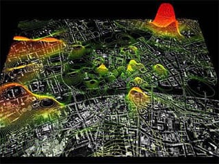
In an earlier look at cell phone use in Europe, MIT’s Senseable City project mapped out patterns in Graz, Austria. The data included density of cell phone calls, their origins and destinations, and the whereabouts of users.
Bill Detwiler is the Editor for Technical Content and Ecosystem at Celonis. He is the former Editor in Chief of TechRepublic and previous host of TechRepublic's Dynamic Developer podcast and Cracking Open, CNET and TechRepublic's popular online show. Previously, Bill was an IT manager in the social research and energy industries. He has bachelor's and master's degrees from the University of Louisville, where he has also lectured on computer crime and crime prevention.


