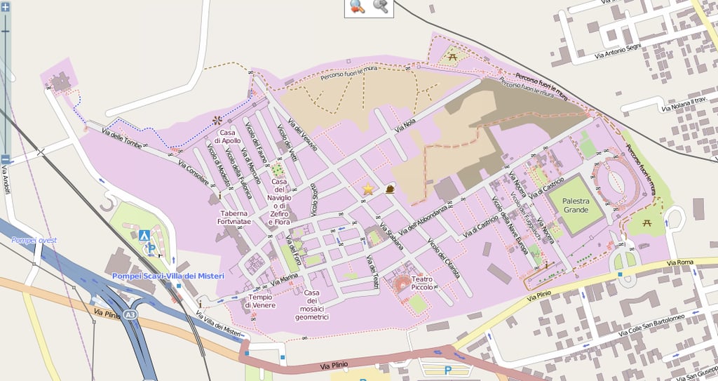
Open Street Map is an open source map of the world, created and amended by people all over the planet. It emphasizes local knowledge, so if you’re in a city and know of a new route or location, you can feel free to add it. There are many types of contributors, from mapping enthusiasts, to professionals, to humanitarians that help add things during disasters. The map shown here was listed as a great example of a community-made map of Pompeii, Italy.
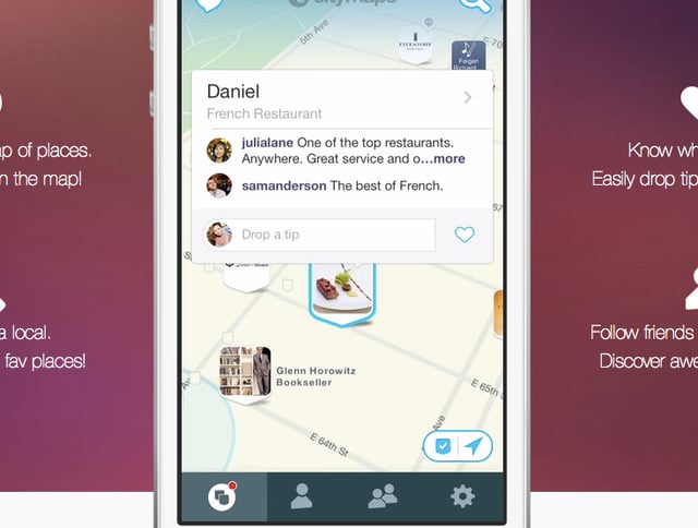
Citymaps is a global social mapping tool, made to integrate with social media and your personal preferences. You can create your own maps on the go, explore your friends maps, and share yours with others. Each store or restaurant location is represented by its logo, making them easy to find, and the app offers turn-by-turn directions as well.
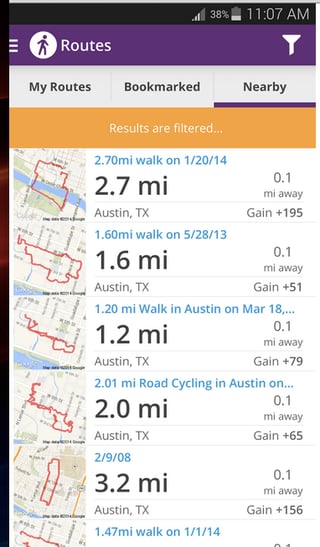
Made by MapMyFitness, MapMyWalk is great for accurately tracking your walks, whether they are for business, travel, exercise, or leisure. Create routes, find routes, or save routes, count calories, mileage, and pace, and even sync your music. The company also has separate apps for biking, hiking, and running, but here’s a quick tip: you can do all the activities from any of the apps by just using the “Activity” setting when recording your workout.
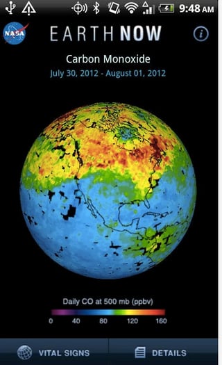
This app visualizes global climate data from satellites so you can view carbon monoxide, carbon dioxide, air temperatures, and water vapor levels. At the bottom are color-coded legends to show you how they vary around the world. The Earth can rotate 360 degrees, and you can zoom in and out with the swipe of a finger.
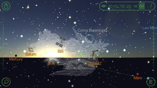
This stargazing app allows you to map the constellations, no matter where you are. There are over 200,000 celestial bodies to view on the app, which gives you information, extra views, and stories about them. Just point your phone to the night sky.
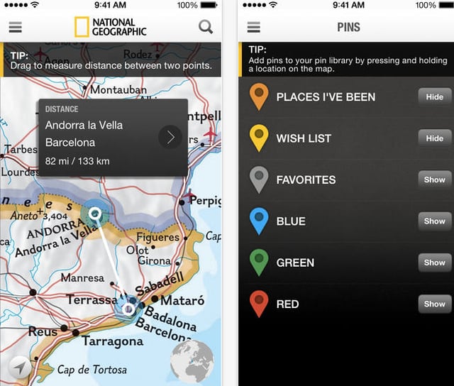
To satisfy your natural wanderlust, check out National Geographic’s atlas map, which has high-resolution photos and maps of the world. Pin where you want to go or where you’ve been before, with weather information, currency conversions, and other specific details about a location. It has an interactive 3D globe and different types of maps to look at: classic, antique, satellite, or road.
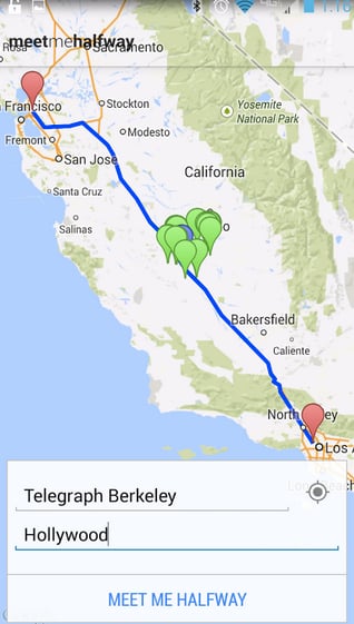
We’ve all been in this situation: trying to figure out where to meet a friend for lunch, but it’s too hard to figure out an easy place to meet that’s easy to drive to. With this app, you can simply put both points in and figure out a halfway point to meet. Filter your results based on what you want to do, then open or share it in Google Maps.
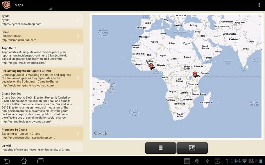
Made by Ushahidi, Crowdmap is an open source mapping platform for visualizing and sharing stories. The Ushahidi platform is free and open source, so downloading the app allows you to take advantage of all of its apps and services. Crowdmap has been useful for disaster relief, violence incidents, and other international crises, but it also shows community maps all over the world that tell about different people and cultures.
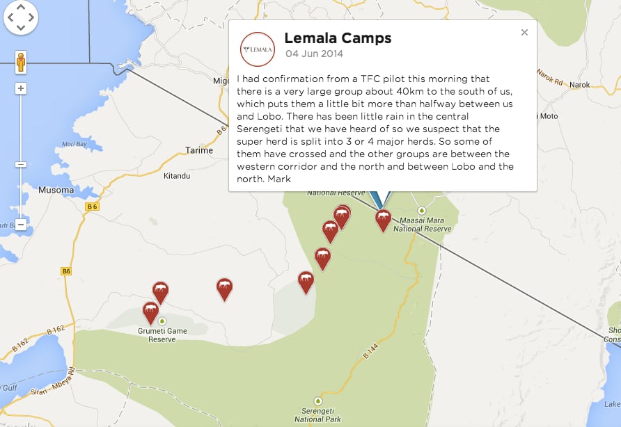
A real time Google map app that was launched by Discover Africa safari operators, Herd Tracker offers updates on a migrating herd’s location. The information is gathered by pilots who fly over the Serengeti and Masai Mara, safari guides and rangers on the ground in various parks in Africa. The photo above is of a map tracking wildebeest migration this year in Serengeti National Park.
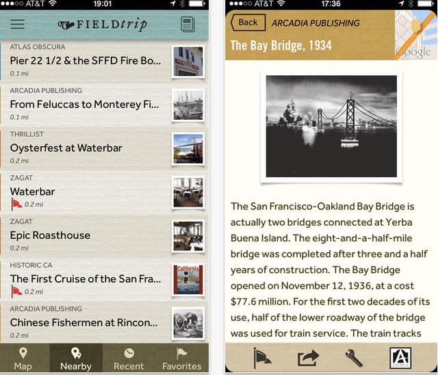
This app is a guide to local, unique places you never knew existed in your area. It runs in the background on your phone, and when you come upon one of these landmarks or activities, a notification pops up to give you more details. The app tells you about local history, or hidden gems you should visit, eat at, or stop in. If you have a headset or bluetooth connected, it can even read the information to you. It’s also available on Google Glass.
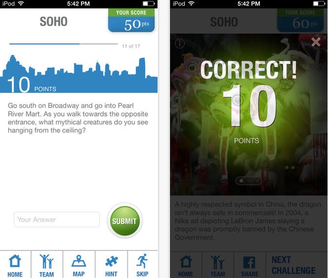
This app turns the world into a scavenger hunt. Pick the number of people in your group, and then take some time to explore your city. Learn history tidbits about the city as you get exercise, venture into new areas, and quiz yourself. You can also turn a map of your favorite places into a scavenger hunt that other people can use, too. It’s only in a dozen cities or so, but Stray Boots is easy to use for all ages.
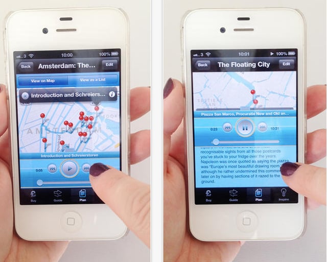
Called the “anti-tour guide,” Cities Talking helps you explore several European cities. It uses Google Maps, so if you download the app, you can follow an on-screen map for a walking tour. Along the way, audio is triggered when you near a point of interest to deliver weird, unique facts about the city.

Lyndsey Gilpin is a former Staff Writer for TechRepublic, covering sustainability and entrepreneurship. She's co-author of the book Follow the Geeks.


