Scientists set out this month to answer questions about the large growth at the bottom of Oregon’s Crater Lake, home of Mt. Mazama, a volcano that erupted about 7,700 years ago. \r\n
\r\nA remotely operated vehicle system will be used to gather video footage and test samples to determine how this natural community fits into the lake’s ecosystem. The research is being carried out by representatives of Oregon State University, the National Park Service, U.S. Geological Survey and Southern Oregon University.\r\n
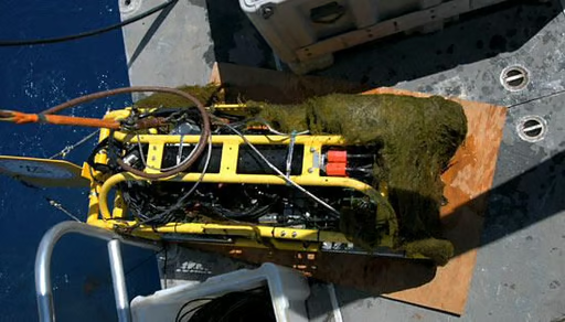
\r\nThe scientists will be using remotely-operated vehicles to explore the moss beds at the bottom of the lake. Pictured here in all its post-moss-exploring glory is the USGS Towed Camera System, which made its journey into the lake earlier this month. The “moss-beard” on the camera sled reflects an “unscheduled contact” with the bottom.\r\n
Crater Lake is one of the clearest bodies of water in the world. There are few places on earth that command such overwhelming awe from\r\nobservers. The clarity of this indescribably blue lake is primarily due to the extremely low concentration of suspended particles and nutrients\r\nto support algae and aquatic plant growth.
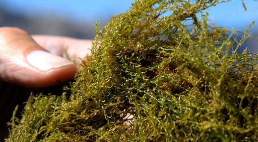
A close-up of some of the sample moss pulled from the bottom of Crater Lake.
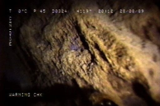
Hidden far below the lake surface, a remarkable deep-water moss community (Depancladus aduncus) may represent the bulk of the biomass in the entire lake ecosystem. This thick band of moss encircles the lake at depths from 85 to 460 feet. This is growing moss hanging down from on the north wall of the caldera at 384-foot depth.
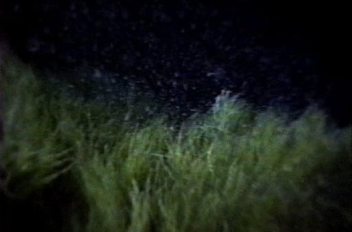
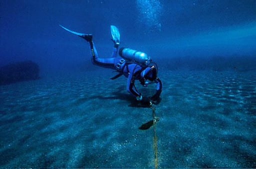
Lush beds of moss cover the gentler slopes around Wizard Island. This photograph was taken during a night dive by Bob Collier from the submersible Deep Rover in 1988.
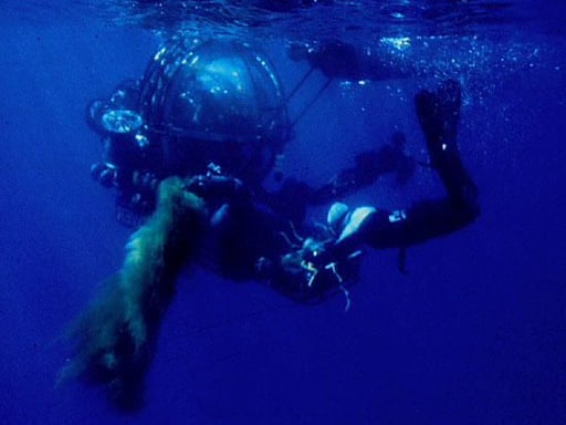
This moss was the first described and sampled during Deep Rover submarine program in the late 1980s by Crater Lake National Park biologist\r\nMark Buktenica and colleagues at Oregon State University.
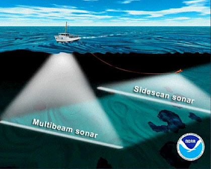
Further evidence of the moss distribution was uncovered during recent high-resolution multibeam sonar surveys. Since the moss beds do not\r\nreflect the sonar sound back to the surface as well as the hard surfaces of the caldera wall, Pete Dartnell (USGS) predicted the moss distribution throughout the lake using a model of sonar backscatter intensity.
The USGS National Seafloor Mapping and Benthic Habitat Studies Project.
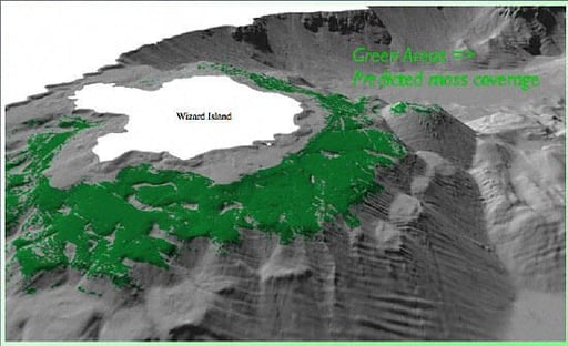
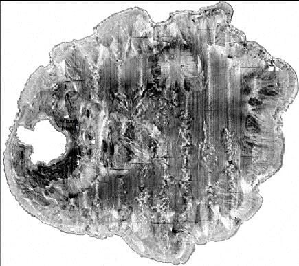
Backscatter intensity: Dark areas may help identify moss.
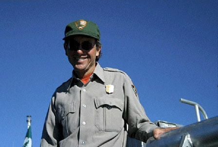
Photograph of Mark Buktenica
Bill Detwiler is the Editor for Technical Content and Ecosystem at Celonis. He is the former Editor in Chief of TechRepublic and previous host of TechRepublic's Dynamic Developer podcast and Cracking Open, CNET and TechRepublic's popular online show. Previously, Bill was an IT manager in the social research and energy industries. He has bachelor's and master's degrees from the University of Louisville, where he has also lectured on computer crime and crime prevention.


