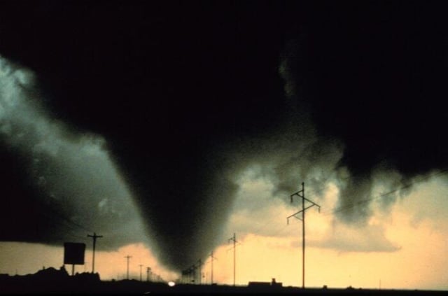
The Dimmitt tornado is one of the most thoroughly observed and studied tornadoes in history. Project VORTEX (Verification of the Origins of Rotation in Tornadoes Experiment) is a joint research project of the National Severe Storms Laboratory (NSSL), the National Oceanic and Atmospheric Administration (NOAA), and the University of Oklahoma and its Center for Analysis and Prediction of Storms (among other universities and groups).
\n
VORTEX researchers wanted to know why some storms form tornadoes and others don’t. With the help of an array of mobile storm chasing equipment and aircraft, they measured the tornadic column to be approximately nine miles high with winds of up to 175 mph. Sharp images were returned by the Doppler on Wheels, revealing hurricane-like inflow bands, a near circular eyewall, and a center almost clear of debris.
\n
VORTEX 1 data was collected from 1994 to 1995, and VORTEX 2 kicks off this year in May.
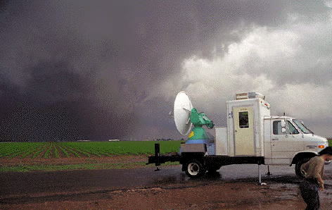
“The Doppler On Wheels (DOW) Project has created two mobile Doppler weather radars mounted on trucks that have explored rare, short-lived and small scale phenomena, permitting the first ever mappings of tornado winds, hurricane wind streaks, and resolution of detailed tornado structure and evolution at scales well below 100 m.” See the DOW page at the Center for Severe Weather Research for more of the technical specs.\n
Credit: NOAA/NSSL
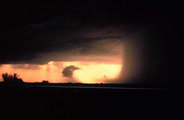
This downburst is near Wichita Falls, TX in May 1994. Downbursts occur when rain-cooled air hits the surface and spreads out in all directions, producing strong wind shear.\n\n
Credit: NOAA/NSSL
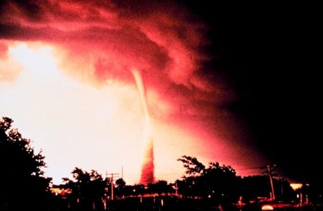
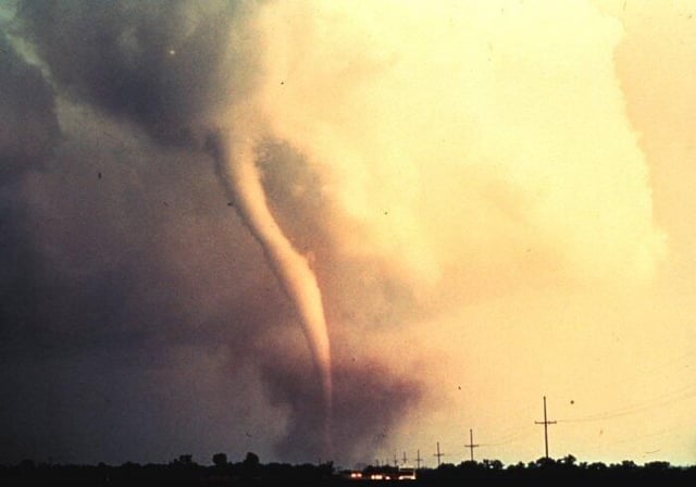
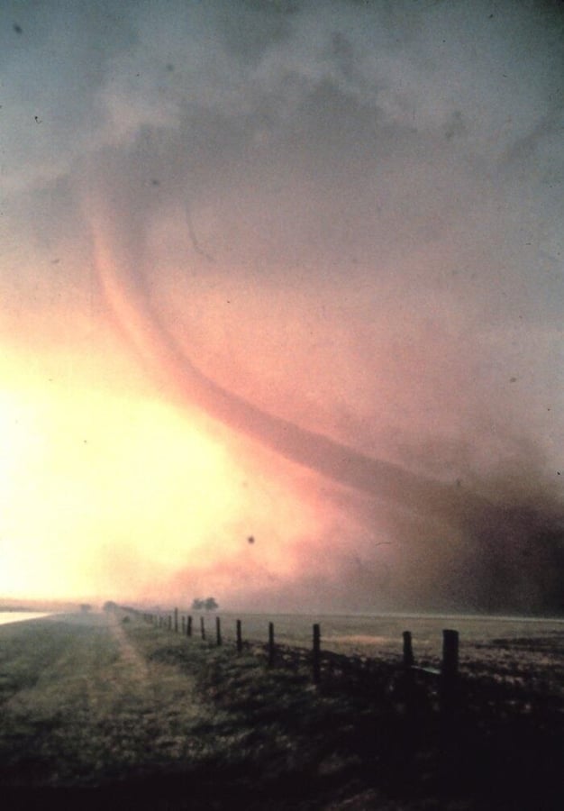
Dust and debris have been carried almost half-way to cloud base in this classic photo of a tornado on June 5, 1966.\n
This photo and most of the images in this gallery can be found in the NOAA’s Photo Library.\n\n
Credit: NOAA/NSSL
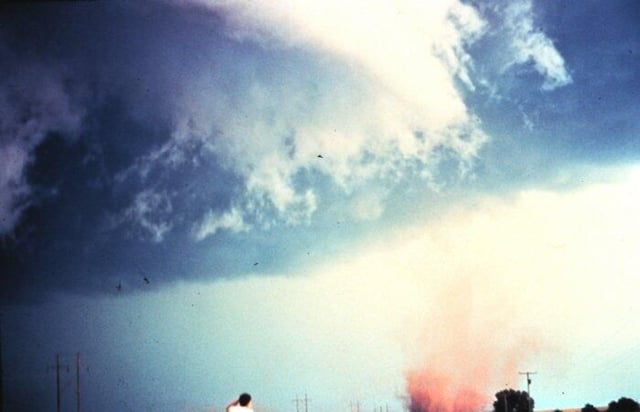
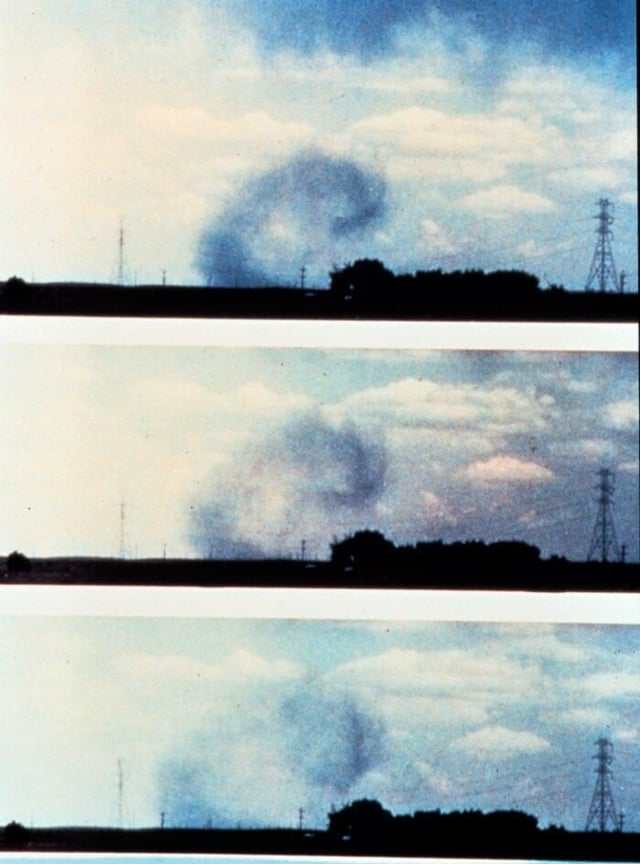
This is the first tornado captured by the NSSL doppler radar and NSSL chase personnel. The tornado is here in its early stage of formation. \n\n
Credit: NOAA/NSSL
This photo is from Alva, OK on June 10, 1975. This tornado featured anti-cyclonic circulation, an anomaly in which circulation is clockwise, unlike 98 percent of tornadoes in the Northern Hemisphere. These type of tornadoes are often, but not always, smaller and weaker than cyclonic tornadoes.\n\n
Credit: NOAA/NSSL
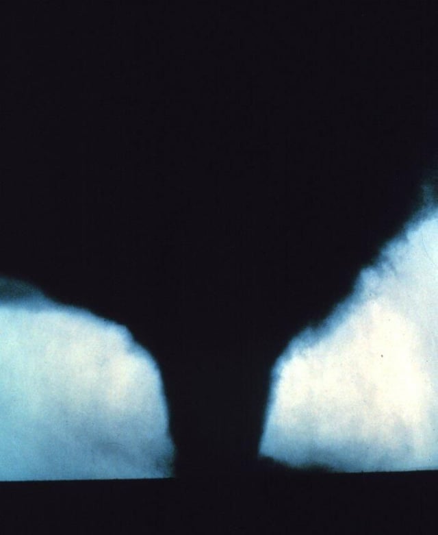
A mature tornado and very menacing-looking funnel cloud fills the sky. This one was rated an F2 and, thankfully, rolled over mostly uninhabited countryside.\n\n
Credit: NOAA/NSSL
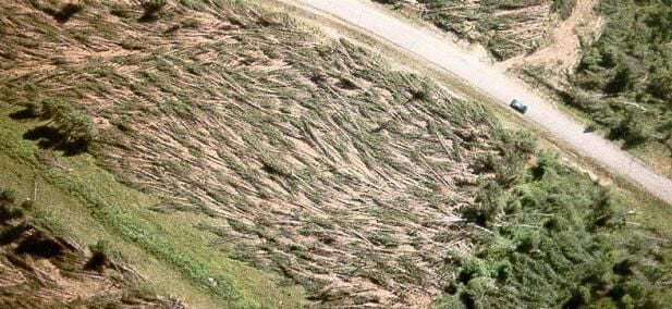
This famous July 4 downburst devastated an area 166 miles long and up to 17 miles wide. Straight-line winds likely exceeded 115 mph in Sawyer County. “A large section of the Flambeau State Forest, including trees four feet in diameter, were flattened. One person was killed in a camper and eight injuries were reported in Sawyer county.”\n\n
Credit: NOAA/NSSL
A microburst is a localized column of sinking air characterized by straight-line winds at the surface that diverge (rather than converge, as in tornadoes). Microbursts can be accompanied by rain or not, and are extremely dangerous to aircraft due to the wind shear. A microburst is a type of downburst.\n\n
Credit: NOAA/NSSL
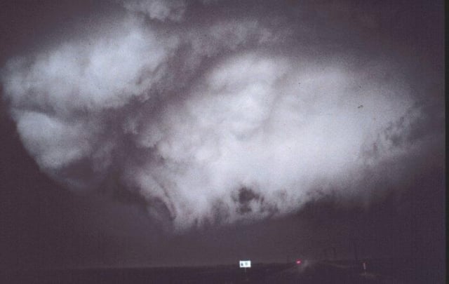
Wall clouds are associated with thunderstorms and if they begin to rotate, they may develop into tornadoes. They form as a lowering in the cloud base when some rain-cooled air is pulled upward, along with the more buoyant air, creating a strong updraft. \n\n
Credit: NOAA/NSSL
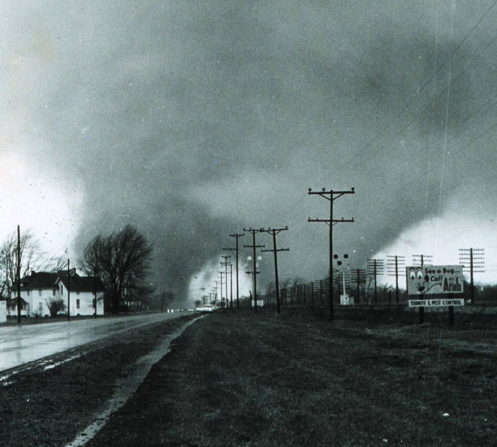
Known as the Palm Sunday Tornado Outbreak, a swarm of tornadoes hit several midwestern states, including this (later rated) F5 (wind speeds of 261-318 mph) double tornado. One of the worst outbreaks in U.S. history, these monster storms killed over 250 people and caused nearly half a billion dollars in property damage.\n\n
Credit: NOAA/NSSL

Selena Frye is a former Senior Editor for TechRepublic. Her background is in technical writing, editing, and research. I edit the Data Center, Linux and Open Source, Apple in the Enterprise, and IT Security blogs.


