Google Maps has collaborated with NASA researchers at Arizona State University to present brightly colored, detailed maps of the Red Planet. \r\n\r\n
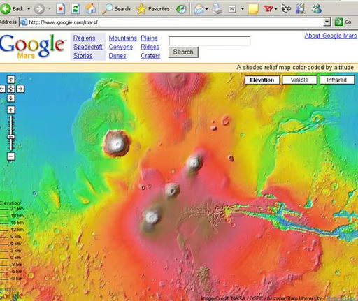
The opening screen shows a wide range of features: volcanoes, rivers, plains–pretty much what an Earth geographical map looks like.
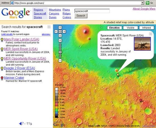
The easiest way to use the map is to click on a category on top and then click on the matches. Under “Spacecraft” you can find the landing site of the Mars Rover Spirit.
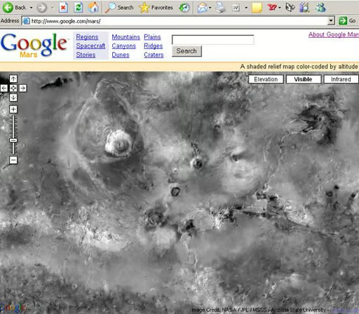
For a shaded relief map of Mars, click on “Visible” and you’ll get a mosaic of images from the Mars Orbiter Camera on NASA’s Mars Global Surveyor.
Google Mars says it chose a gray-scale to better highlight images over the planet’s true color which looks like butterscotch.
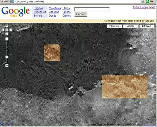
The infrared map is taken from wavelengths that are invisible to the human eye. Higher resolution mosaics are highlighted within the image.

To find out about Martian geographical features, click on a category and then one of the search results. Clicking on the feature’s name will bring up a NASA article which explains the feature in more detail.

This map shows where the “Face on Mars” was found and lets you read the story behind its legend.

From the farthest zoom back, you can see the map repeats three times.
Bill Detwiler is the Editor for Technical Content and Ecosystem at Celonis. He is the former Editor in Chief of TechRepublic and previous host of TechRepublic's Dynamic Developer podcast and Cracking Open, CNET and TechRepublic's popular online show. Previously, Bill was an IT manager in the social research and energy industries. He has bachelor's and master's degrees from the University of Louisville, where he has also lectured on computer crime and crime prevention.


