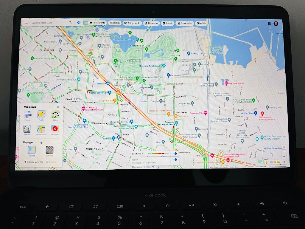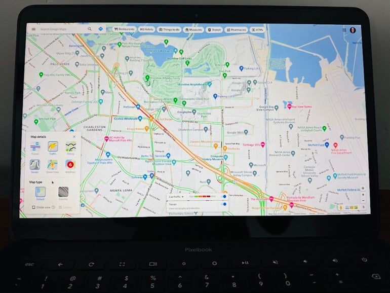
If you’ve ever used a map on a Chromebook, you’ve likely used Google Maps. Fans of satellite imagery may also have explored Google Earth. Both of these apps are obvious map options for people who use a Chromebook.
SEE: How to use Google Maps to chat with businesses (TechRepublic)
That said, Chromebook owners may access many other maps that may be useful for a variety of business and education purposes. Whether you seek a hotel, a specific meeting spot, a stylized map or detailed depiction of data, each of the options covered below merit exploration. Sign in to your Chromebook and follow each of the links below.
Start with Google’s map offerings
Google Maps and Google Earth offer detailed global maps. Google Maps (Figure A, left) places a priority on navigation and general information, which is what many people want from a map most of the time. Google Maps not only offers walking, bicycling, transit, driving and flying directions but also lists business hours, popular times and reviews for many places.
Figure A
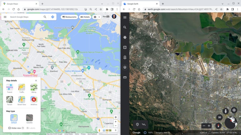
You may install Google Maps as a Progressive Web App, if you like. Google Earth (Figure A, right), in contrast, focuses first on the display of satellite images, supplemented with photography and information about notable sites. Explore sites around the world with predefined tours via the Voyager tab or create your own sets of places via the Projects tab to save or share.
Explore alternative maps
Bing Maps and MapQuest
You might also explore other general purpose, navigation focused maps such as Microsoft’s Bing Maps or System1’s MapQuest. Both of these mapping services offer driving routes and information, along with the ability to search and filter by various categories, such as hotels, restaurants and gas stations. With the traffic layer selected, Bing Maps offers access to available roadway webcams, which can be useful when assessing travel conditions.
OpenStreetMap.org
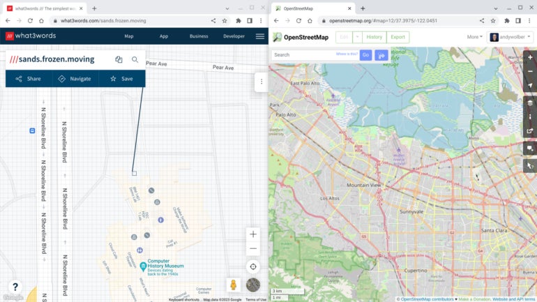
OpenStreetMap.org (Figure B, right) offers another alternative general purpose map, that includes information about roads, business and points of interest. What sets OpenStreetMap.org apart, however, is that it is community-driven: Note the prominent placement of the Edit button. Much like Wikipedia, OpenStreetMap offers the ability to contribute changes to the map. You will, however, need to create a free OpenStreetMap account in order to do so.
Figure B
what3words
what3words (Figure B, left) focuses on a specific use: identifying every 3-square-meter location on the globe with a unique combination of three words. Need to meet someone in a particular spot outside a building? Hone in on the place on the what3words map, click on the specific spot, then share the three-word combination with your colleagues.
Other mapping sites
A few other mapping sites offer additional data:
- Snazzy Maps offers custom styles that let you significantly change how Google Maps displays.
- Stamen Design offers a variety of map styles that work with OpenStreetMap data.
- Mapillary offers access to street view images of a huge number of places around the world.
Access feature-focused maps
Other maps prioritize particular datasets, such as information related to travel, topography or weather. Sygic Maps, for example, emphasizes hotels, restaurants, museums and other tourism-related locations (Figure C, left). And plane and ship tracking sites, such as ADS-B Exchange and MarineTraffic, let you track air and sea activity, respectively, which can be an indicator of economic activity, such as tourism and trade.
Figure C
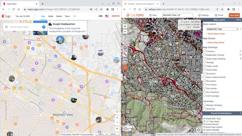
CalTopo seeks to serve the needs of people who maneuver in places without roads. CalTopo started as a service to help search-and-rescue teams and now provides a wide range of detailed topographic-related maps and data to emergency responders, hikers, planners and recreationalists (Figure C, right). Moreover, weather-focused sites, such as Ventusky, Windy and Zoom Earth, offer a global, map-centric view of recent, current and predicted weather.
Some maps allow you to select from a variety of layers, while others depict distinctive datasets. For example, both National Geographic MapMaker and ArcGIS Living Atlas of the World offer access to data layers that depict various environmental, population, health and land use datasets, all easily selectable. The Native Land map identifies the territories and areas of activity of indigenous peoples. A highly focused map, such as MacroStrat.org, focuses solely on the display of geological data.
Create custom maps
The ability to create maps allows you to show locations and sets of locations, indicate routes, and annotate map features. Esri ArcGIS Online set the standard for highly capable and comprehensive cloud-based software that lets you create, collaborate and analyze maps.
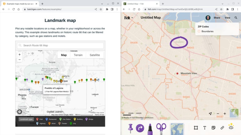
BatchGeo, another custom map, helps you transform lists of data in a spreadsheet into data displayed on a Google Map (Figure D, left). And Felt, in beta as of January 2023, offers an elegantly designed interface to help people annotate maps together (Figure D, right).
Figure D
What’s your experience with maps on a Chromebook?
If you use maps on a Chromebook, which are your favorite map apps? Which of the above maps do you use most often? Are there other speciality-focused maps you use that you find valuable? Mention or message me on Mastodon (@awolber) to let me know what map apps you recommend.
