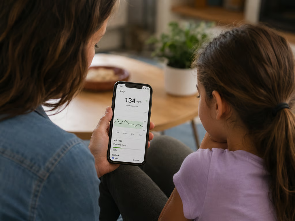
Image: Metamorworks/Getty Images/iStock
New software from Esri allows real-time analysis of IoT data to make it easier to act quickly on geospatial information from thousands of sensors.
ArcGIS Velocity has the capability to ingest, process, visualize and analyze high volumes of data as it comes in, the company says. The platform can capture data from moving objects or objects that change over time and send alerts about anomalies. This real-time capability is key to getting an ROI from IoT installations, officials said.
Jack Dangermond, Esri founder and president, said in a press release that these new capabilities allow users to use live data for improved situational awareness. The platform can be used for remote monitoring of assets, predictive maintenance, and process optimization, according to the company.
SEE: 5 Internet of Things (IoT) innovations (free Pdf) (TechRepublic)
Roger Cleaves, a GIS specialist in the California Department of Toxic Substances Control, said in a press release that the cloud-based platform allows his team to start answering important questions regarding hazardous waste instantaneously.
“Being able to have real-time insight into vehicle travel across the state has always seemed like a pipe-dream, but ArcGIS Velocity makes it not only a reality, but an easy-to-achieve reality,” Cleaves stated.
Cleaves said he sees many use cases for the software including real-time notifications, capacity planning, and environmental impact modeling.
The platform includes these features: Geofencing, buffering, pattern detection, spatial aggregation, special enrichment, and proximity alerts. The platform can send analysis as alerts or be directly published as GIS maps.
According to the company, users can incorporate geospatial analysis into their decision-making and share results in a map, feature, or stream service that can be used in other ArcGIS applications. ArcGIS Velocity is an update of the company’s ArcGIS Analytics for IoT product.
There are now two additional license levels for the software—standard and advanced. The two options offer different storage and compute capabilities and are designed to fit the needs of users in industries such as commercial, natural resources, utilities, transportation, national government, water and wastewater, and public safety.
Esri also recently announced that the core data and services that provide the infrastructure for ArcGIS available to developers through APIs and web frameworks, as Natalie Gagliordi reported on ZDNet. The platform lets developers use Esri’s location services using the APIs and web frameworks of choice, including open source clients. Developers also can create apps using ArcGIS APIs, SDKs, and app builders, according to the article.
As Brandon Viglarolio described in an article for TechRepublic, Ericsson identified asset condition monitoring for self-monitoring machines as a key trend in 2021 for Industry 4.0 transformation.
In the report, Ericsson found that manufacturers with connected hardware reduced the need for spare parts by 10%. This is due to the fact that machines can monitor their conditions and report small changes in the operation of a machine that could lead to a long-term problem.
Ericsson’s analysis also found a significant ROI from asset condition monitoring, in addition to decreases in downtime, reduced material costs, and more efficient use of labor.